
This work is licensed under a Creative Commons / Attribution-ShareAlike 3.0 Unported License.
This work is licensed under a
Creative Commons / Attribution-ShareAlike 3.0 Unported License.
This ontology marks up information about the British Trench Map Coordinate system used by Great Britain and its Dominions during the Great War. As part of the Muninn project, it was necessary to identify and translate the coordinate system to modern logitude and latitudes using a WGS84 datum.
This onlogy contains the different intances of all known map sheets used, the relationships that bind them and the underlying organisation of the coordinate system. It is currently used to drive coordinate translation applications and as a reference to the different battlefields of the conflict. Ontological structures are borrowed from the modern British Ordonance Ontologies1 as well as from other ontologies.

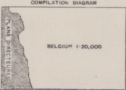
With the invasion of Belgium by the Germans, the Belgian plates for their countries maps were made
A trench map is made from several different sources of mapping information: on site surveys, larger scale maps (1:100,000), fire direction maps and the original 1:40,000 belgium grid plates.
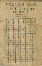
Every map at the 1:40,000 level has a short thumbnail on the margin
of the sheet that explains the sources used to create the specific
sheet. In the case of the image below, this specific map was created
from the Belgian plates and the French
 According to Winterbotham, the
accuracy you can expect of the map varies wildly depending on the source
used to create it. While the reprojection of large scale maps
(1:100,000) down to smaller (1:40,000) scale was performed often at the
begining of the war, one could expect errors of about 200 yards. A
survey units making maps from sightings or arial photographs would aim
for an accuracy of about 20 yards.
According to Winterbotham, the
accuracy you can expect of the map varies wildly depending on the source
used to create it. While the reprojection of large scale maps
(1:100,000) down to smaller (1:40,000) scale was performed often at the
begining of the war, one could expect errors of about 200 yards. A
survey units making maps from sightings or arial photographs would aim
for an accuracy of about 20 yards.
The grid precision goes down to a box of 50x50 yards and with the help of a very good eye and a romer, a box of 5x5 yards. This would be assuming that the position would be properly fixed by a soldier in an environment that was not perticularly ideal. This also meant that positions were assumed to be "roughly there" and anything requiring good precision, such as tunneling and registering artillery fire, would require some specialist survey teams.
The 1:40,000 maps were the basic map series from which operations where planned and situational awereness acheived. The basic Belgian grid is extended by adding alphabetic extensions to the basic grid for areas outside of Belgium. Be aware that not all grids are listed below and more exist for the 1:40,000 grid.
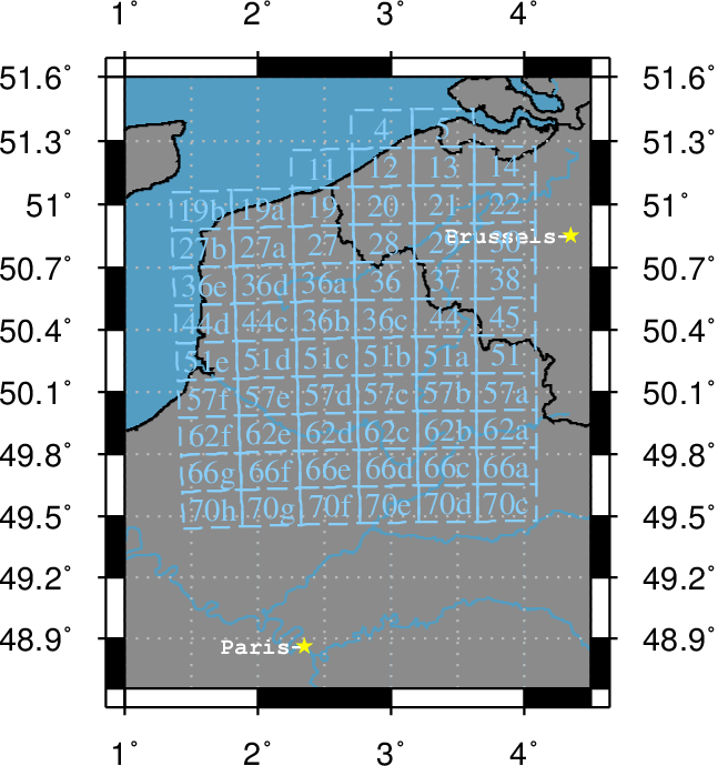
The 1:40,000 grids were subdivided into several 1:20,000 and 1:10,000 sheets.
The 1:10,000 maps were the primary maps used by the front line officers and enlisted men by providing small scale views of the battlefields. Each 1:10,000 map was a quadran of a 1:40,000 map, named NW, SW, NE, or SE.
The ontology provides the following properties:
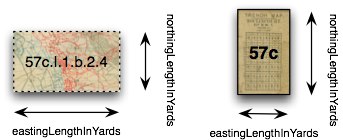
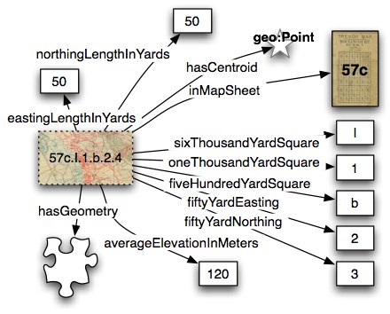
While the properties are used by both sheets and references, their application are slightly different in both cases due to the hybrid nature of the metric / imperial system. The actual physical size of the represented terrain is encoded the same way for both sheets and references.
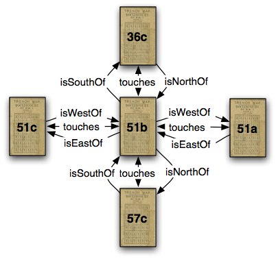
Sheets within the grid are organized so that each grid touches another exactly at its edges.
Trench Map references where created as an imperial measurement grid over a metric projection. Be aware that the origins of an easting and northing are relative to an origin. Within the Belgian grid, the origin is at Brussels. In the Grid Reference, the origin is the South West corner of the square.
The area covered by the grid reference is translated to a longitude and latitude with a WGS84 datum. Currently there are two ways to represent a polygon in linked open data: using the methods preferred by Linked Geo Data and as a collection of geo:Point nodes. A centroid is reported for both Map grid and Map reference for use in labeling on large scale maps.
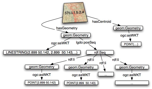
Figure x represents the structure used by linked geo data for the representation of a polygon using a rdf mapping used by virtrdf:Geometry http://virtuoso.openlinksw.com and GeoSPARQL ogcsparqkhttp://www.opengis.net/rdf#. Both are an rdf serialization of the opengis standard which encapsulates the XML standards into litterals.
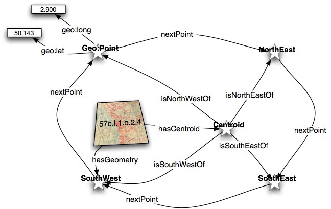
Figure y represents the structure using a series of geo:Points that are linked together using two properties that enforce the ordering of Points in the polygon. The intent of this representation is to make the longtiude and latitude accessible through a SPARQL or XPATH query without parsing while making the enforcement of point ordering OWL safe.
The use of within and contains properties relates the grid reference to its parent and child grid references as well as adjacent grid references.
Classes: GridReference, GridSquare, MapSheet,
Properties: averageElevationInMeters, centroidOf, contains, currentLocationOf, easting, eastingLengthInYards, fiftyYardEasting, fiftyYardNorthing, fiveHundredYardSquare, hasCentroid, hasGeometry, heading, headingMagnetic, headingTrueNorth, inMapSheet, isEastOf, isNorthOf, isSouthOf, isWestOf, mapRevisionDate, mapSeries, nextPoint, northing, northingLengthInYards, oneThousandYardSquare, partiallyOverlaps, previousPoint, sixThousandYardSquare, touches, wasLocationOf, within,
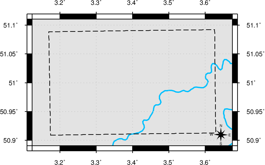
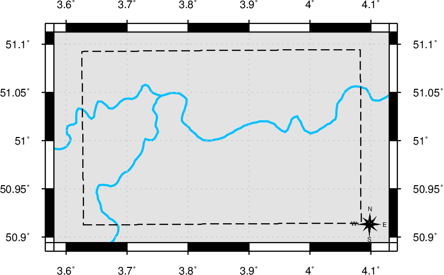
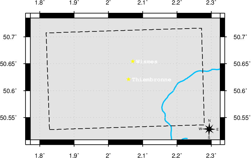
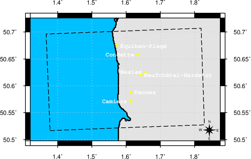
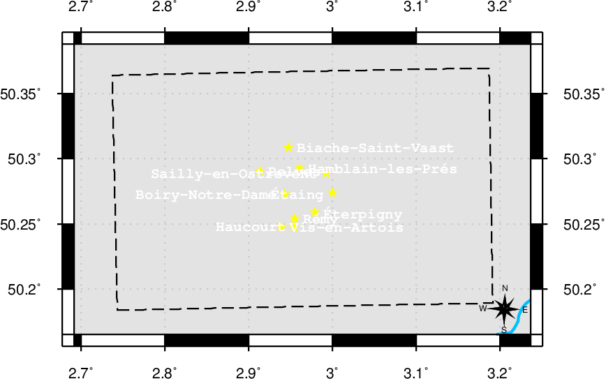
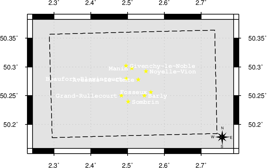
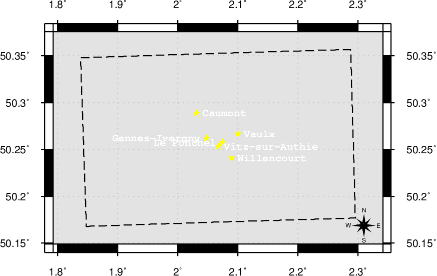
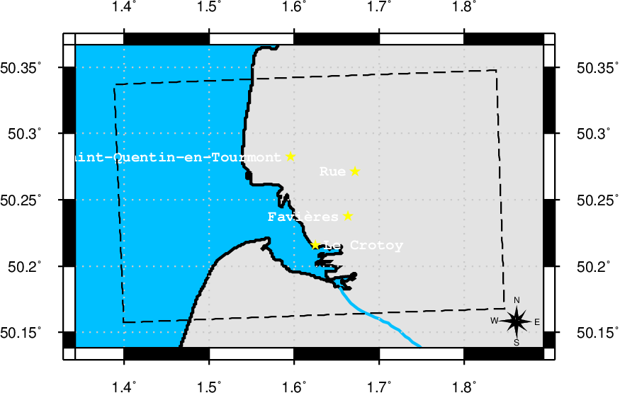
Instances: 40000-11, 40000-12, 40000-13, 40000-14, 40000-19, 40000-19a, 40000-19b, 40000-20, 40000-21, 40000-22, 40000-27, 40000-27a, 40000-27b, 40000-28, 40000-29, 40000-30, 40000-36, 40000-36a, 40000-36b, 40000-36c, 40000-36d, 40000-36e, 40000-37, 40000-38, 40000-4, 40000-44, 40000-44c, 40000-44d, 40000-45, 40000-5, 40000-51, 40000-51a, 40000-51b, 40000-51c, 40000-51d, 40000-51e, 40000-57a, 40000-57b, 40000-57c, 40000-57d, 40000-57e, 40000-57f, 40000-62a, 40000-62b, 40000-62c, 40000-62d, 40000-62e, 40000-62f, 40000-66a, 40000-66c, 40000-66d, 40000-66e, 40000-66f, 40000-66g, 40000-70c, 40000-70d, 40000-70e, 40000-70f, 40000-70g, 40000-70h,
URI: http://rdf.muninn-project.org/ontologies/btmaps#GridReference
Grid Reference - A Grid Reference is a location within a MapSheet which at its largest scale equals the area of a Map Sheet.
No detailed documentation for this term.
URI: http://rdf.muninn-project.org/ontologies/btmaps#GridSquare
Grid Square -
No detailed documentation for this term.
URI: http://rdf.muninn-project.org/ontologies/btmaps#MapSheet
Map Sheet - A specific sheet within the map grid.
No detailed documentation for this term.
URI: http://rdf.muninn-project.org/ontologies/btmaps#averageElevationInMeters
Average Elevation (Meters) -
No detailed documentation for this term.
URI: http://rdf.muninn-project.org/ontologies/btmaps#centroidOf
Centroid Of - The longitude and latitude is the centroid of this reference - use for labeling.
No detailed documentation for this term.
URI: http://rdf.muninn-project.org/ontologies/btmaps#contains
contains -
No detailed documentation for this term.
URI: http://rdf.muninn-project.org/ontologies/btmaps#currentLocationOf
current Location Of - This grid currently is the location of an event or item.
No detailed documentation for this term.
URI: http://rdf.muninn-project.org/ontologies/btmaps#easting
Easting - The easting is the distance in meters from the false origin to the western side of the grid square.
No detailed documentation for this term.
URI: http://rdf.muninn-project.org/ontologies/btmaps#eastingLengthInYards
East-West length of the grid square (Yards) -
No detailed documentation for this term.
URI: http://rdf.muninn-project.org/ontologies/btmaps#fiftyYardEasting
fiftyYardEasting -
No detailed documentation for this term.
URI: http://rdf.muninn-project.org/ontologies/btmaps#fiftyYardNorthing
fiftyYardNorthing -
No detailed documentation for this term.
URI: http://rdf.muninn-project.org/ontologies/btmaps#fiveHundredYardSquare
fiveHundredYardsSquare -
No detailed documentation for this term.
URI: http://rdf.muninn-project.org/ontologies/btmaps#hasCentroid
Has Centroid - The longitude and latitude of the centroid of this reference - use for labeling.
No detailed documentation for this term.
URI: http://rdf.muninn-project.org/ontologies/btmaps#hasGeometry
Has Geometry - Has Geometry
No detailed documentation for this term.
URI: http://rdf.muninn-project.org/ontologies/btmaps#heading
Heading in Degrees -
No detailed documentation for this term.
URI: http://rdf.muninn-project.org/ontologies/btmaps#headingMagnetic
Magnetic Heading in Degrees -
No detailed documentation for this term.
URI: http://rdf.muninn-project.org/ontologies/btmaps#headingTrueNorth
True North Heading in Degrees -
No detailed documentation for this term.
URI: http://rdf.muninn-project.org/ontologies/btmaps#inMapSheet
In Map Sheet -
No detailed documentation for this term.
URI: http://rdf.muninn-project.org/ontologies/btmaps#isEastOf
is East Of -
No detailed documentation for this term.
URI: http://rdf.muninn-project.org/ontologies/btmaps#isNorthOf
is North Of -
No detailed documentation for this term.
URI: http://rdf.muninn-project.org/ontologies/btmaps#isSouthOf
is South Of -
No detailed documentation for this term.
URI: http://rdf.muninn-project.org/ontologies/btmaps#isWestOf
is West Of -
No detailed documentation for this term.
URI: http://rdf.muninn-project.org/ontologies/btmaps#mapRevisionDate
Map Revision Date - The date on which this specific map sheet was revised - map sheets of the same series would have different overlays printed on them with updated trench positions.
No detailed documentation for this term.
URI: http://rdf.muninn-project.org/ontologies/btmaps#mapSeries
Map Series - The Series number of the perticular set of sheets that this specific map sheet is part of. (e.g.: GS2743)
No detailed documentation for this term.
URI: http://rdf.muninn-project.org/ontologies/btmaps#nextPoint
Next Point - Next point in a sequence of Points. Used for creating fast polygons.
No detailed documentation for this term.
URI: http://rdf.muninn-project.org/ontologies/btmaps#northing
Northing - The northing is the distance in meters from the false origin to the south side of the grid square.
No detailed documentation for this term.
URI: http://rdf.muninn-project.org/ontologies/btmaps#northingLengthInYards
North-South length of the grid square (Yards) -
No detailed documentation for this term.
URI: http://rdf.muninn-project.org/ontologies/btmaps#oneThousandYardSquare
oneThousandYardSquare -
No detailed documentation for this term.
URI: http://rdf.muninn-project.org/ontologies/btmaps#partiallyOverlaps
overlaps -
No detailed documentation for this term.
URI: http://rdf.muninn-project.org/ontologies/btmaps#previousPoint
Previous Point - Previous point in a sequence of Points. Used for creating fast polygons.
No detailed documentation for this term.
URI: http://rdf.muninn-project.org/ontologies/btmaps#sixThousandYardSquare
sixThousandYardSquare -
No detailed documentation for this term.
URI: http://rdf.muninn-project.org/ontologies/btmaps#touches
touches - The boundaries of the two objects intersect but their interiors do not.
No detailed documentation for this term.
URI: http://rdf.muninn-project.org/ontologies/btmaps#wasLocationOf
was Location Of - This grid was the location of an event or item.
No detailed documentation for this term.
URI: http://rdf.muninn-project.org/ontologies/btmaps#within
within -
No detailed documentation for this term.
URI: http://rdf.muninn-project.org/ontologies/btmaps#40000-11
11 - British Trench Map, 1:40,000 scale. Any series using the Revised System of Squaring.
 | 40000-12 | |
URI: http://rdf.muninn-project.org/ontologies/btmaps#40000-12
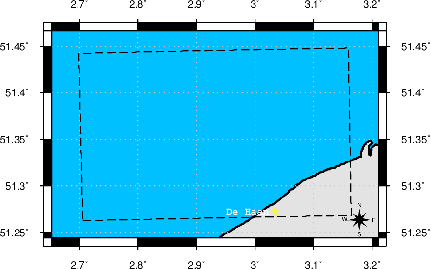
12 (Belgian coast (southern section)) - British Trench Map, 1:40,000 scale. Any series using the Revised System of Squaring.
| 40000-4 | ||
 | 40000-13 | |
URI: http://rdf.muninn-project.org/ontologies/btmaps#40000-13
13 - British Trench Map, 1:40,000 scale. Any series using the Revised System of Squaring.
| 40000-5 | ||
 | 40000-14 | |
URI: http://rdf.muninn-project.org/ontologies/btmaps#40000-14
14 - British Trench Map, 1:40,000 scale. Any series using the Revised System of Squaring.
 | ||
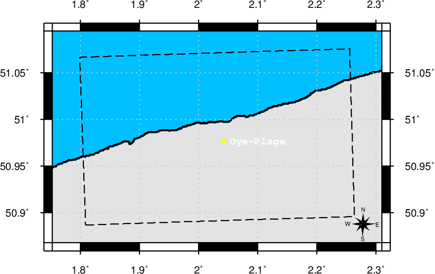
URI: http://rdf.muninn-project.org/ontologies/btmaps#40000-19
19 - British Trench Map, 1:40,000 scale. Any series using the Revised System of Squaring.
| 40000-11 | ||
 | 40000-20 | |
URI: http://rdf.muninn-project.org/ontologies/btmaps#40000-19a
19a - British Trench Map, 1:40,000 scale. Any series using the Revised System of Squaring.
 | 40000-19 | |
URI: http://rdf.muninn-project.org/ontologies/btmaps#40000-19b
19b - British Trench Map, 1:40,000 scale. Any series using the Revised System of Squaring.
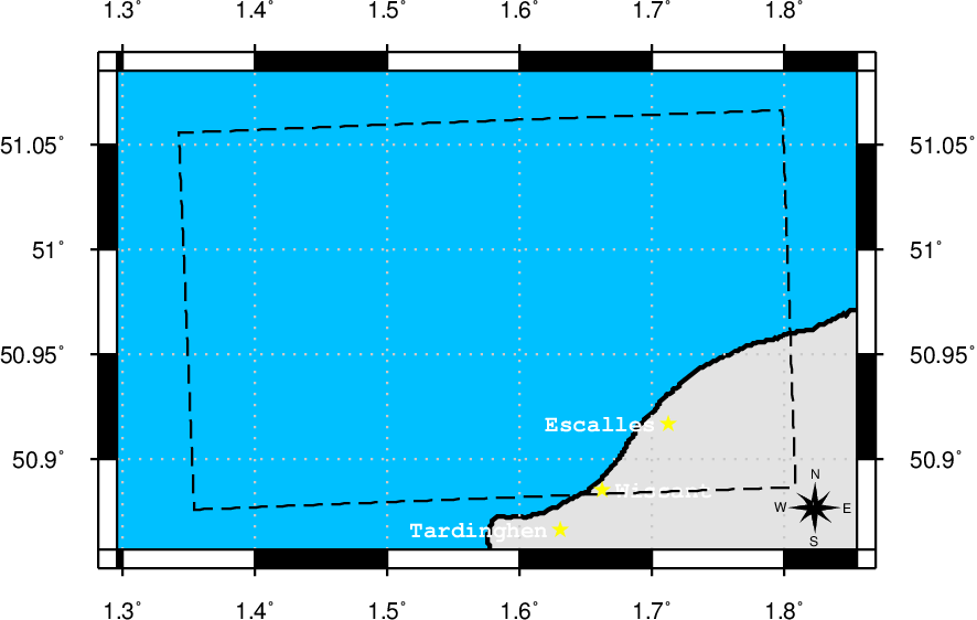 | ||
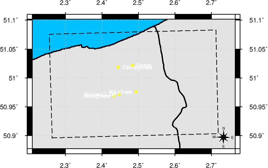
URI: http://rdf.muninn-project.org/ontologies/btmaps#40000-20
20 (Dixmude area) - British Trench Map, 1:40,000 scale. Any series using the Revised System of Squaring.
| 40000-12 | ||
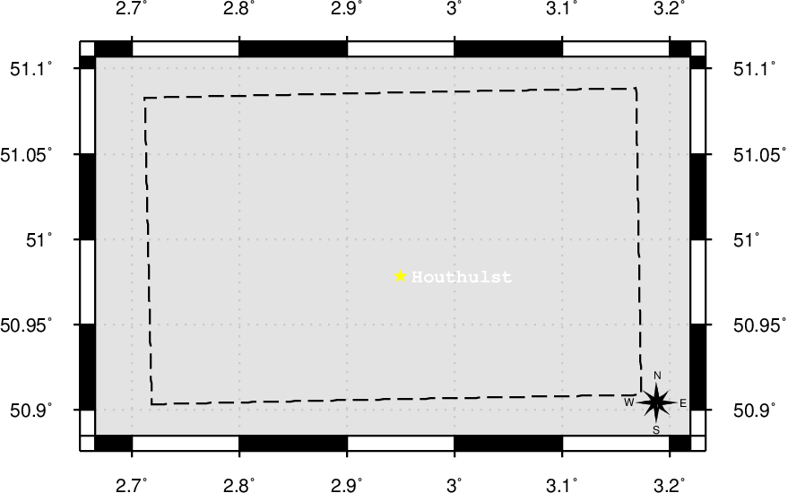 | 40000-21 | |
URI: http://rdf.muninn-project.org/ontologies/btmaps#40000-21
21 - British Trench Map, 1:40,000 scale. Any series using the Revised System of Squaring.
| 40000-13 | ||
 | 40000-22 | |
URI: http://rdf.muninn-project.org/ontologies/btmaps#40000-22
22 - British Trench Map, 1:40,000 scale. Any series using the Revised System of Squaring.
| 40000-14 | ||
 | ||
URI: http://rdf.muninn-project.org/ontologies/btmaps#40000-27
27 - British Trench Map, 1:40,000 scale. Any series using the Revised System of Squaring.
| 40000-19 | ||
 | 40000-28 | |
URI: http://rdf.muninn-project.org/ontologies/btmaps#40000-27a
27a - British Trench Map, 1:40,000 scale. Any series using the Revised System of Squaring.
| 40000-19a | ||
 | 40000-27 | |
URI: http://rdf.muninn-project.org/ontologies/btmaps#40000-27b
27b - British Trench Map, 1:40,000 scale. Any series using the Revised System of Squaring.
| 40000-19b | ||
 | ||
URI: http://rdf.muninn-project.org/ontologies/btmaps#40000-28
28 (Ypres area) - British Trench Map, 1:40,000 scale. Any series using the Revised System of Squaring.
| 40000-20 | ||
 | 40000-29 | |
URI: http://rdf.muninn-project.org/ontologies/btmaps#40000-29
29 - British Trench Map, 1:40,000 scale. Any series using the Revised System of Squaring.
| 40000-21 | ||
 | 40000-30 | |
URI: http://rdf.muninn-project.org/ontologies/btmaps#40000-30
30 - British Trench Map, 1:40,000 scale. Any series using the Revised System of Squaring.
| 40000-22 | ||
 | ||
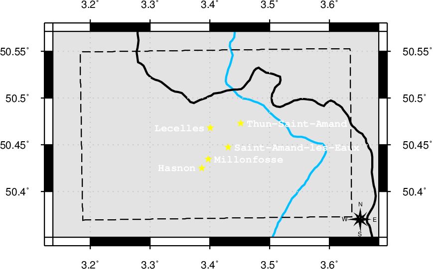
URI: http://rdf.muninn-project.org/ontologies/btmaps#40000-36
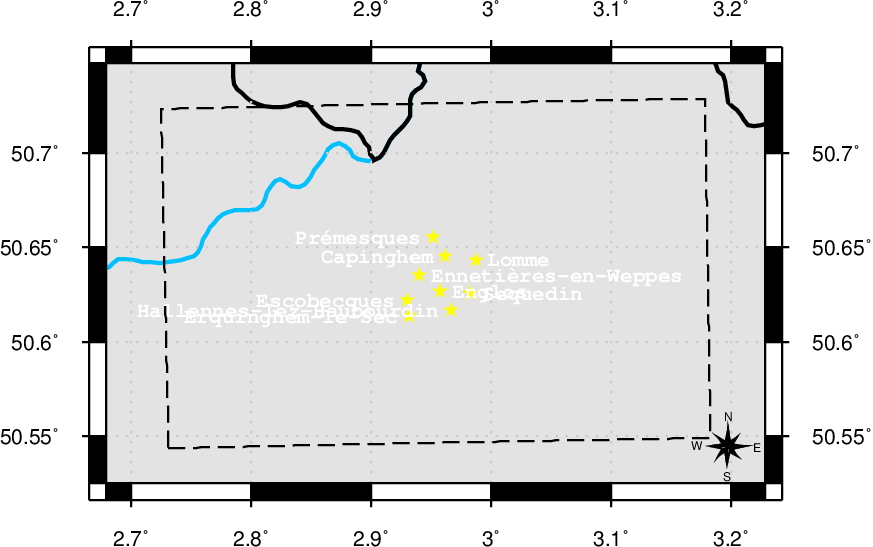
36 (Armentières-Lille area) - British Trench Map, 1:40,000 scale. Any series using the Revised System of Squaring.
| 40000-28 | ||
 | 40000-37 | |
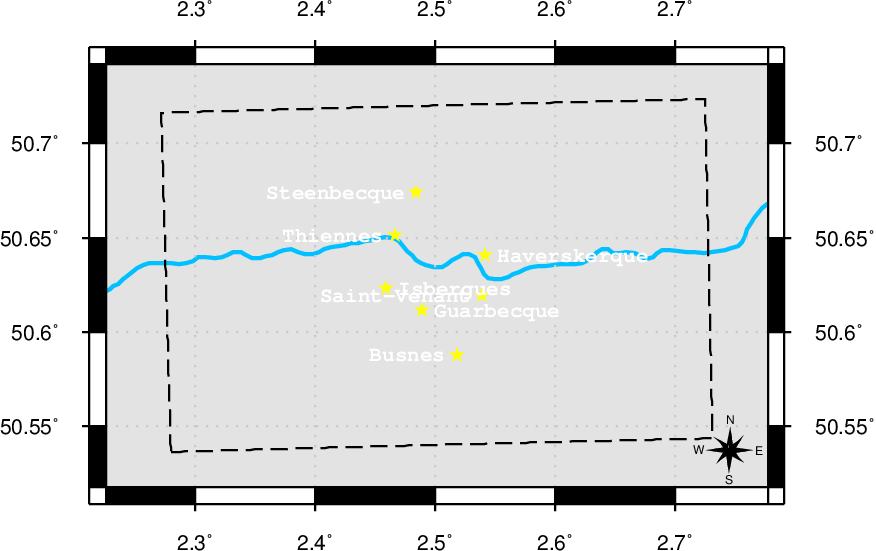
URI: http://rdf.muninn-project.org/ontologies/btmaps#40000-36a
36a - British Trench Map, 1:40,000 scale. Any series using the Revised System of Squaring.
| 40000-27 | ||
 | 40000-36 | |
URI: http://rdf.muninn-project.org/ontologies/btmaps#40000-36b
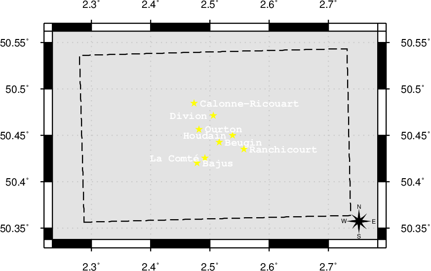
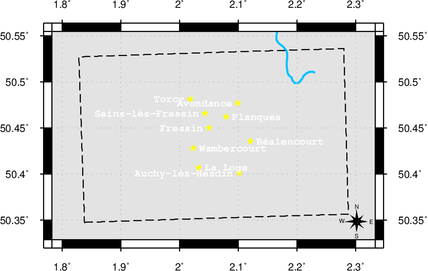
36b (44b) - British Trench Map, 1:40,000 scale. Any series using the Revised System of Squaring.
| 40000-36a | ||
 | 40000-36c | |
URI: http://rdf.muninn-project.org/ontologies/btmaps#40000-36c
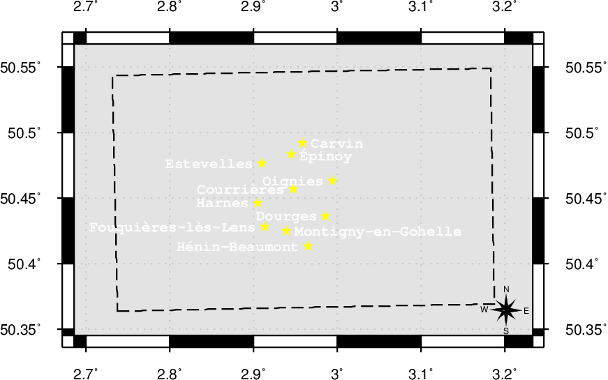
36c (La Bassée-Loos area) - British Trench Map, 1:40,000 scale. Any series using the Revised System of Squaring.
| 40000-36 | ||
 | 40000-44 | |
URI: http://rdf.muninn-project.org/ontologies/btmaps#40000-36d
36d - British Trench Map, 1:40,000 scale. Any series using the Revised System of Squaring.
| 40000-27a | ||
 | 40000-36a | |
URI: http://rdf.muninn-project.org/ontologies/btmaps#40000-36e
36e - British Trench Map, 1:40,000 scale. Any series using the Revised System of Squaring.
| 40000-27b | ||
 | ||
URI: http://rdf.muninn-project.org/ontologies/btmaps#40000-37
37 - British Trench Map, 1:40,000 scale. Any series using the Revised System of Squaring.
| 40000-29 | ||
 | 40000-38 | |
URI: http://rdf.muninn-project.org/ontologies/btmaps#40000-38
38 - British Trench Map, 1:40,000 scale. Any series using the Revised System of Squaring.
| 40000-30 | ||
 | ||
URI: http://rdf.muninn-project.org/ontologies/btmaps#40000-4
4 (Belgian coast (northern section)) - British Trench Map, 1:40,000 scale. Any series using the Revised System of Squaring.
 | 40000-5 | |
URI: http://rdf.muninn-project.org/ontologies/btmaps#40000-44
44 - British Trench Map, 1:40,000 scale. Any series using the Revised System of Squaring.
| 40000-37 | ||
 | 40000-45 | |
URI: http://rdf.muninn-project.org/ontologies/btmaps#40000-44c
44c - British Trench Map, 1:40,000 scale. Any series using the Revised System of Squaring.
| 40000-36d | ||
 | 40000-36b | |
URI: http://rdf.muninn-project.org/ontologies/btmaps#40000-44d
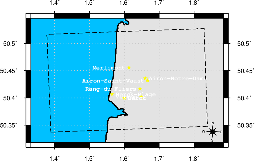
44d - British Trench Map, 1:40,000 scale. Any series using the Revised System of Squaring.
| 40000-36e | ||
 | ||
URI: http://rdf.muninn-project.org/ontologies/btmaps#40000-45
45 - British Trench Map, 1:40,000 scale. Any series using the Revised System of Squaring.
| 40000-38 | ||
 | ||
URI: http://rdf.muninn-project.org/ontologies/btmaps#40000-5
5 - British Trench Map, 1:40,000 scale. Any series using the Revised System of Squaring.
 | ||
URI: http://rdf.muninn-project.org/ontologies/btmaps#40000-51
51 - British Trench Map, 1:40,000 scale. Any series using the Revised System of Squaring.
| 40000-45 | ||
 | ||
URI: http://rdf.muninn-project.org/ontologies/btmaps#40000-51a
51a (Hordain area) - British Trench Map, 1:40,000 scale. Any series using the Revised System of Squaring.
| 40000-44 | ||
 | 40000-51 | |
URI: http://rdf.muninn-project.org/ontologies/btmaps#40000-51b
51b (Arras-Cantin) - British Trench Map, 1:40,000 scale. Any series using the Revised System of Squaring.
| 40000-36c | ||
 | 40000-51a | |
URI: http://rdf.muninn-project.org/ontologies/btmaps#40000-51c
51c (West of Arras) - British Trench Map, 1:40,000 scale. Any series using the Revised System of Squaring.
| 40000-36b | ||
 | 40000-51b | |
URI: http://rdf.muninn-project.org/ontologies/btmaps#40000-51d
51d - British Trench Map, 1:40,000 scale. Any series using the Revised System of Squaring.
| 40000-44c | ||
 | 40000-51c | |
URI: http://rdf.muninn-project.org/ontologies/btmaps#40000-51e
51e - British Trench Map, 1:40,000 scale. Any series using the Revised System of Squaring.
| 40000-44d | ||
 | ||
URI: http://rdf.muninn-project.org/ontologies/btmaps#40000-57a
57a - British Trench Map, 1:40,000 scale. Any series using the Revised System of Squaring.
| 40000-51 | ||
 | ||
URI: http://rdf.muninn-project.org/ontologies/btmaps#40000-57b
57b (Clary area) - British Trench Map, 1:40,000 scale. Any series using the Revised System of Squaring.
| 40000-51a | ||
 | 40000-57a | |
URI: http://rdf.muninn-project.org/ontologies/btmaps#40000-57c
57c (Bapaume-Gonnelieu area) - British Trench Map, 1:40,000 scale. Any series using the Revised System of Squaring.
| 40000-51b | ||
 | 40000-57b | |
URI: http://rdf.muninn-project.org/ontologies/btmaps#40000-57d
57d (Hebuterne area) - British Trench Map, 1:40,000 scale. Any series using the Revised System of Squaring.
| 40000-51c | ||
 | 40000-57c | |
URI: http://rdf.muninn-project.org/ontologies/btmaps#40000-57e
57e - British Trench Map, 1:40,000 scale. Any series using the Revised System of Squaring.
| 40000-51d | ||
 | 40000-57d | |
URI: http://rdf.muninn-project.org/ontologies/btmaps#40000-57f
57f - British Trench Map, 1:40,000 scale. Any series using the Revised System of Squaring.
| 40000-51e | ||
 | ||
URI: http://rdf.muninn-project.org/ontologies/btmaps#40000-62a
62a - British Trench Map, 1:40,000 scale. Any series using the Revised System of Squaring.
| 40000-57a | ||
 | ||
URI: http://rdf.muninn-project.org/ontologies/btmaps#40000-62b
62b (Ramicourt area) - British Trench Map, 1:40,000 scale. Any series using the Revised System of Squaring.
| 40000-57b | ||
 | 40000-62a | |
URI: http://rdf.muninn-project.org/ontologies/btmaps#40000-62c
62c (Péronne area) - British Trench Map, 1:40,000 scale. Any series using the Revised System of Squaring.
| 40000-57c | ||
 | 40000-62b | |
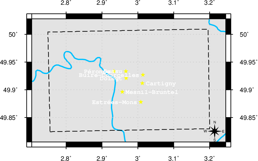
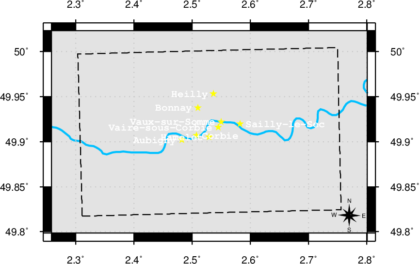
URI: http://rdf.muninn-project.org/ontologies/btmaps#40000-62d
62d (Méaulte area) - British Trench Map, 1:40,000 scale. Any series using the Revised System of Squaring.
| 40000-57d | ||
 | 40000-62c | |
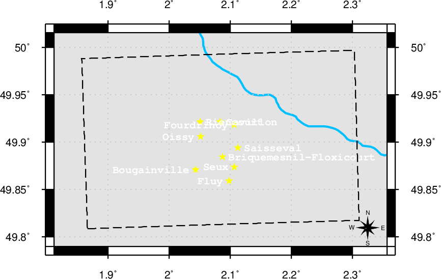
URI: http://rdf.muninn-project.org/ontologies/btmaps#40000-62e
62e - British Trench Map, 1:40,000 scale. Any series using the Revised System of Squaring.
| 40000-57e | ||
 | 40000-62d | |
URI: http://rdf.muninn-project.org/ontologies/btmaps#40000-62f
62f - British Trench Map, 1:40,000 scale. Any series using the Revised System of Squaring.
| 40000-57f | ||
 | ||
URI: http://rdf.muninn-project.org/ontologies/btmaps#40000-66a
66a - British Trench Map, 1:40,000 scale. Any series using the Revised System of Squaring.
| 40000-62a | ||
 | ||
URI: http://rdf.muninn-project.org/ontologies/btmaps#40000-66c
66c (Berthenicourt area) - British Trench Map, 1:40,000 scale. Any series using the Revised System of Squaring.
| 40000-62b | ||
 | 40000-66a | |
URI: http://rdf.muninn-project.org/ontologies/btmaps#40000-66d
66d (Nésle area) - British Trench Map, 1:40,000 scale. Any series using the Revised System of Squaring.
| 40000-62c | ||
 | 40000-66c | |
URI: http://rdf.muninn-project.org/ontologies/btmaps#40000-66e
66e (Moreuil area) - British Trench Map, 1:40,000 scale. Any series using the Revised System of Squaring.
| 40000-62d | ||
 | 40000-66d | |
URI: http://rdf.muninn-project.org/ontologies/btmaps#40000-66f
66f - British Trench Map, 1:40,000 scale. Any series using the Revised System of Squaring.
| 40000-62e | ||
 | 40000-66e | |
URI: http://rdf.muninn-project.org/ontologies/btmaps#40000-66g
66g - British Trench Map, 1:40,000 scale. Any series using the Revised System of Squaring.
| 40000-62f | ||
 | ||
URI: http://rdf.muninn-project.org/ontologies/btmaps#40000-70c
70c - British Trench Map, 1:40,000 scale. Any series using the Revised System of Squaring.
| 40000-66a | ||
 | ||
URI: http://rdf.muninn-project.org/ontologies/btmaps#40000-70d
70d (St. Gobain area) - British Trench Map, 1:40,000 scale. Any series using the Revised System of Squaring.
| 40000-66c | ||
 | 40000-70c | |
URI: http://rdf.muninn-project.org/ontologies/btmaps#40000-70e
70e - British Trench Map, 1:40,000 scale. Any series using the Revised System of Squaring.
| 40000-66d | ||
 | 40000-70d | |
URI: http://rdf.muninn-project.org/ontologies/btmaps#40000-70f
70f - British Trench Map, 1:40,000 scale. Any series using the Revised System of Squaring.
| 40000-66e | ||
 | 40000-70e | |
URI: http://rdf.muninn-project.org/ontologies/btmaps#40000-70g
70g - British Trench Map, 1:40,000 scale. Any series using the Revised System of Squaring.
| 40000-66f | ||
 | 40000-70f | |
URI: http://rdf.muninn-project.org/ontologies/btmaps#40000-70h
70h - British Trench Map, 1:40,000 scale. Any series using the Revised System of Squaring.
| 40000-66g | ||
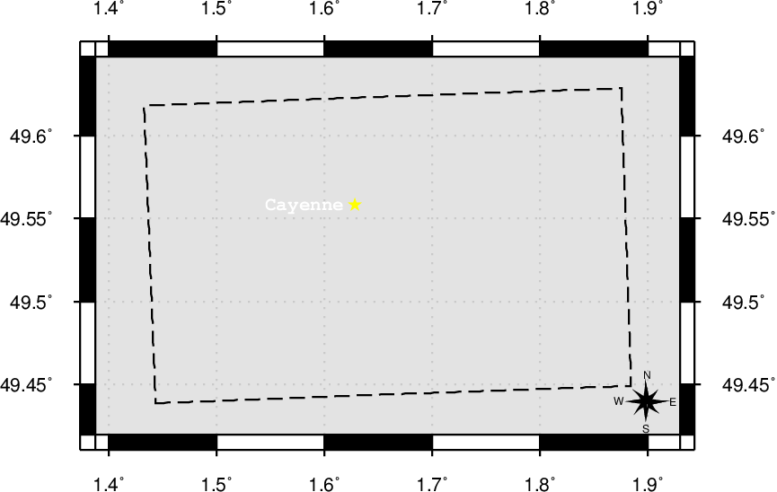 | ||
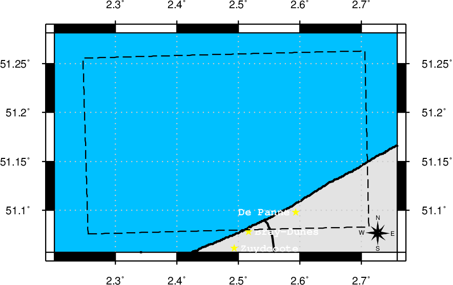
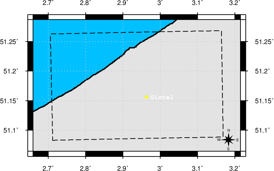
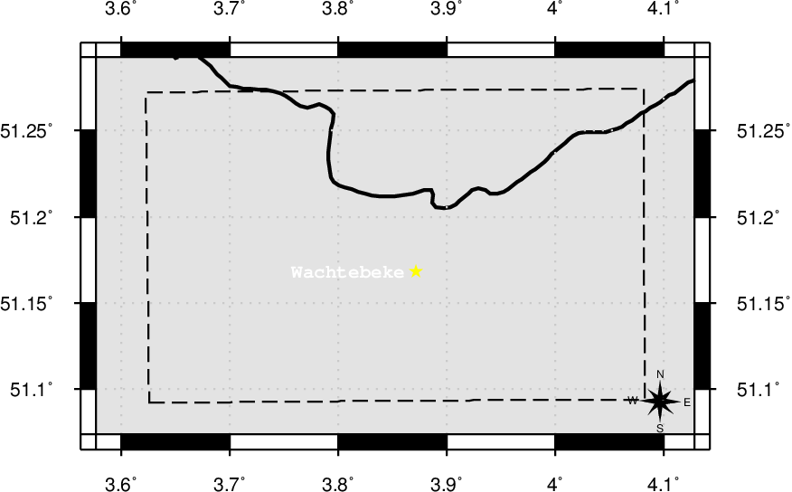
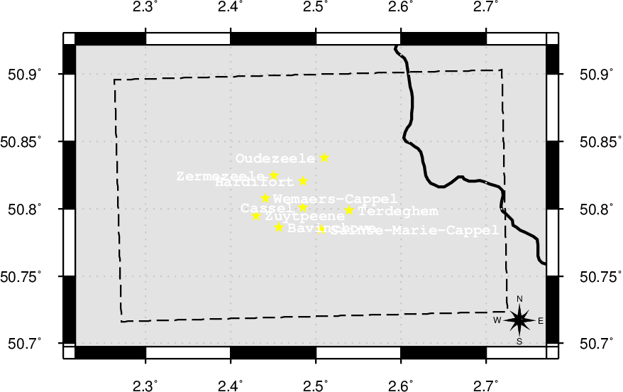
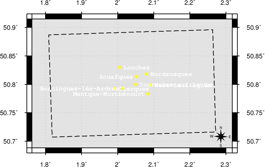
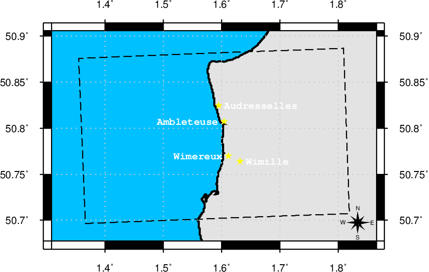
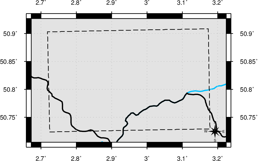
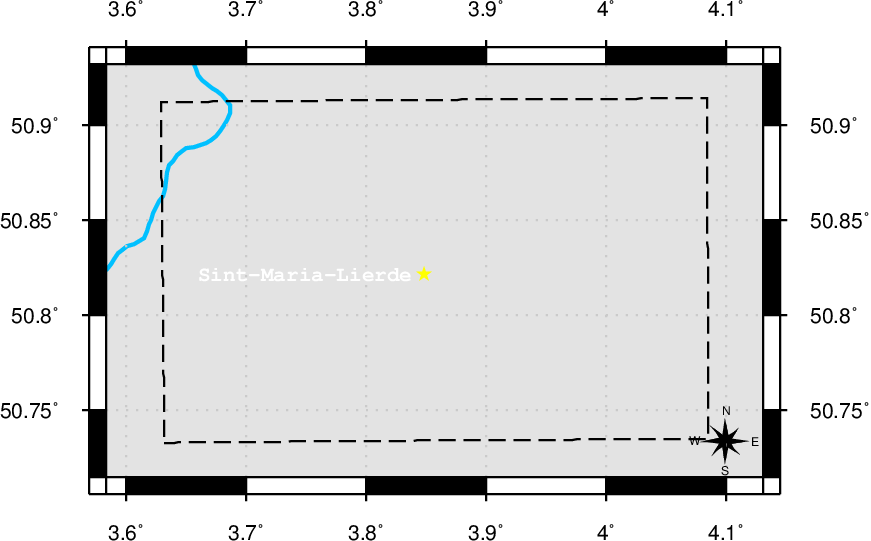
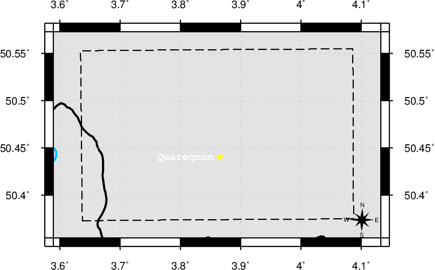
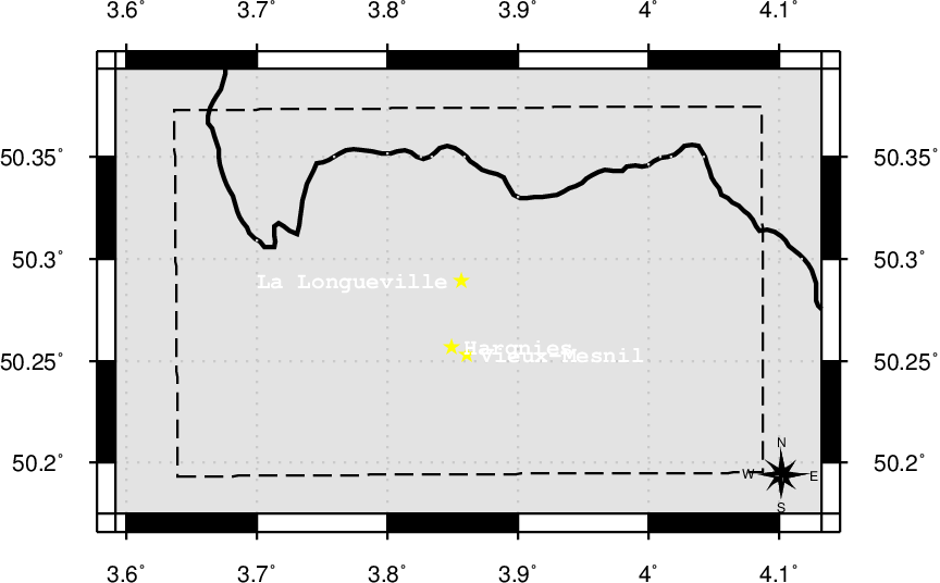
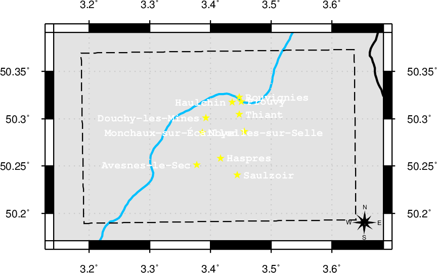
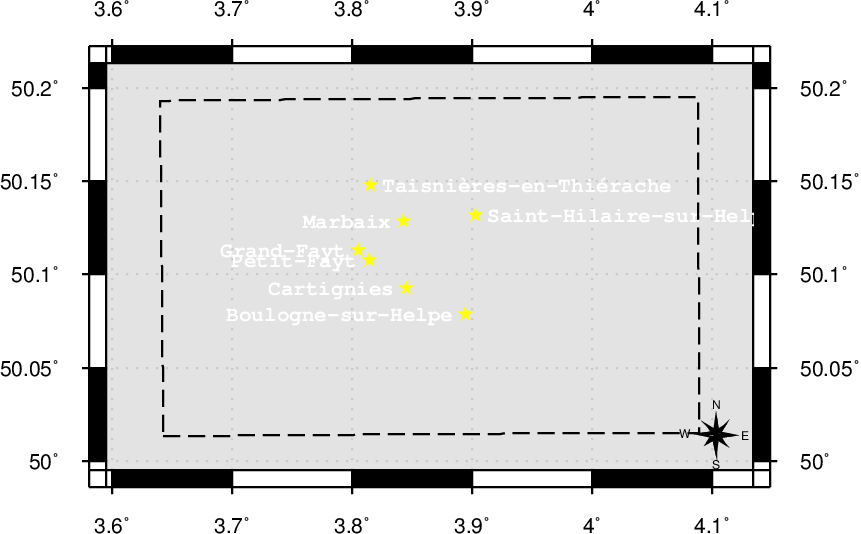
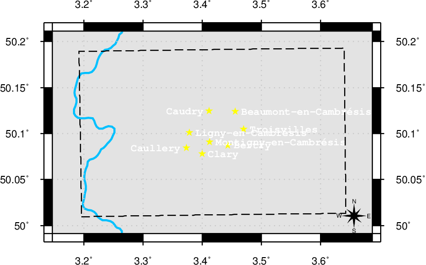
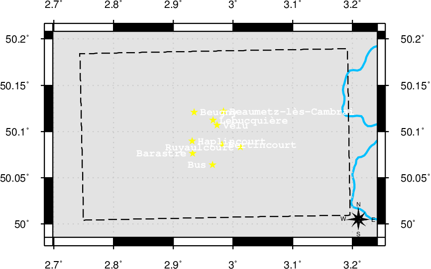
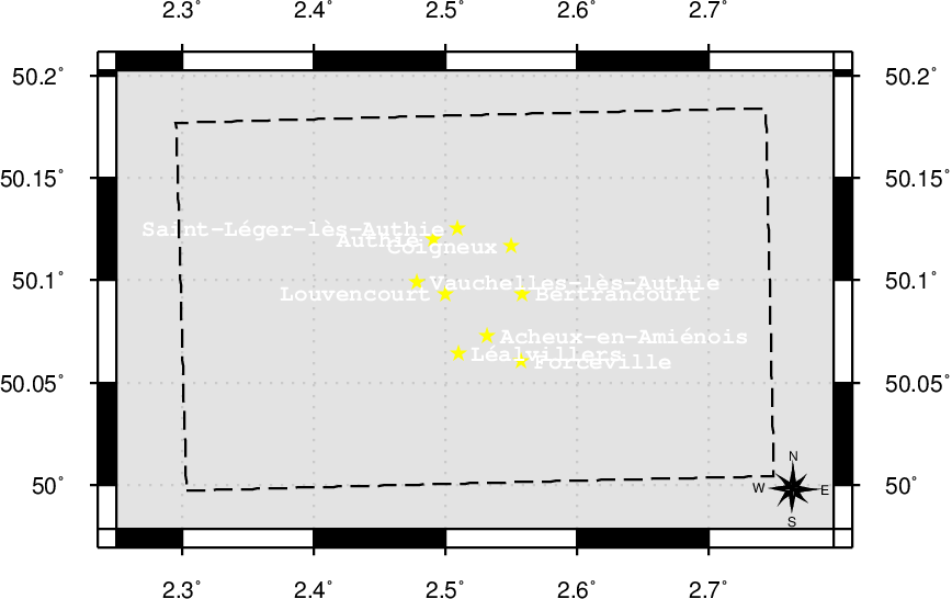
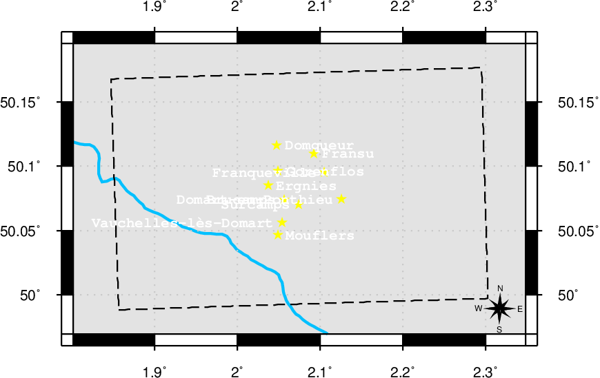
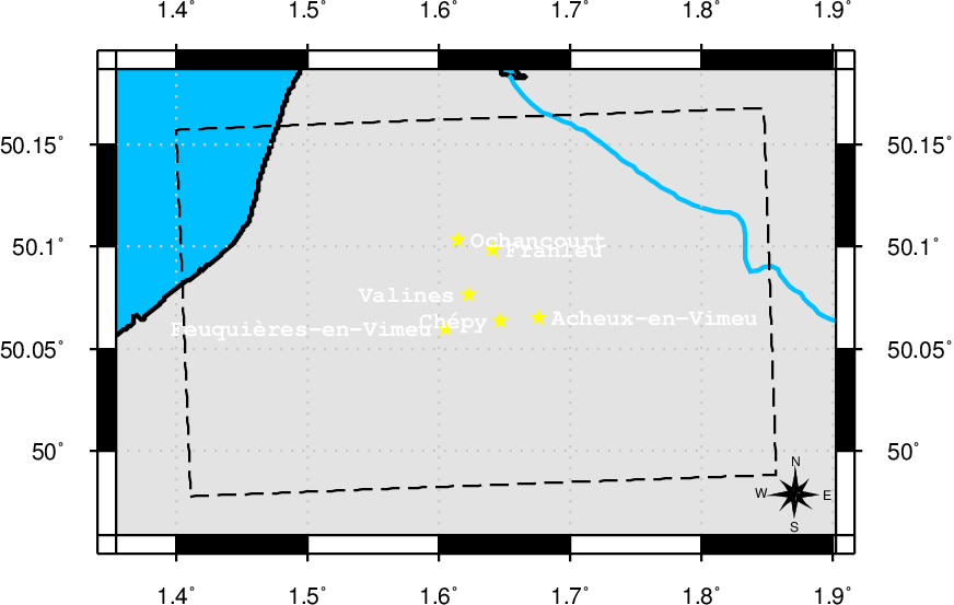
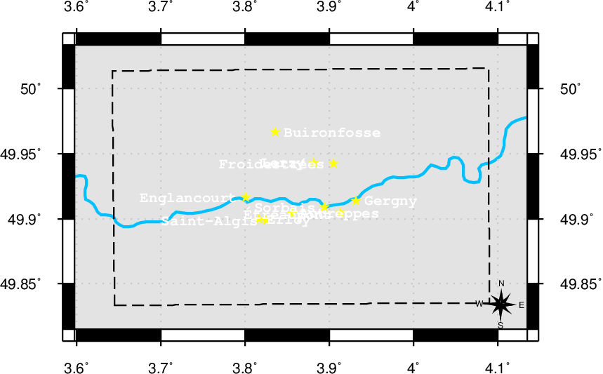
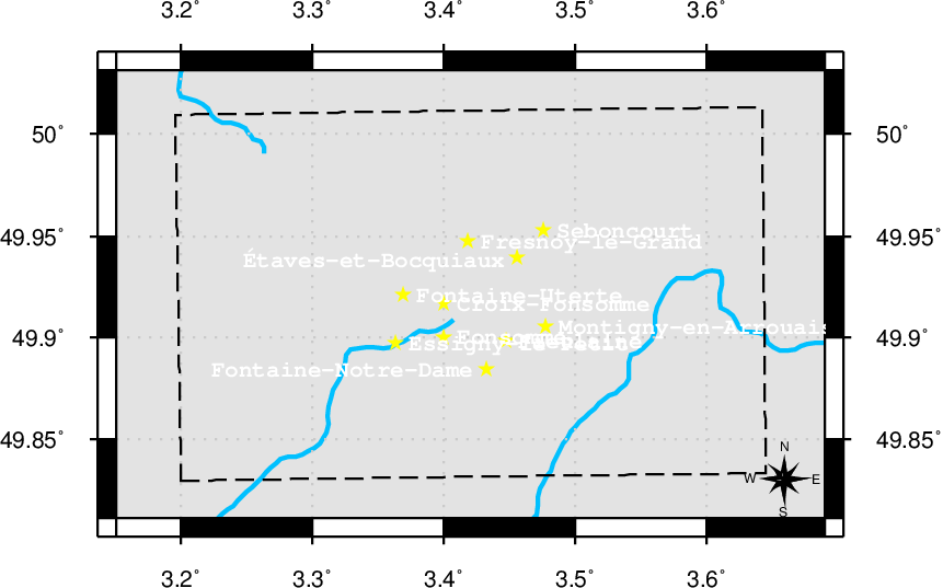
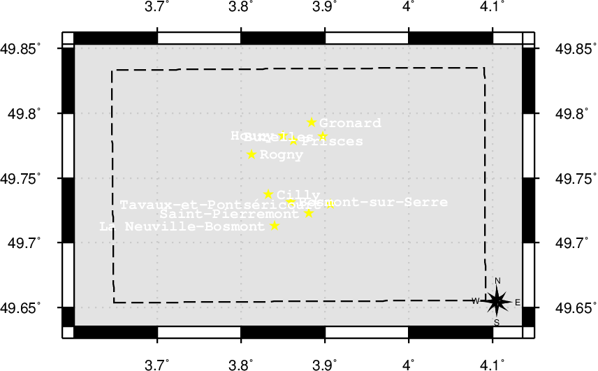
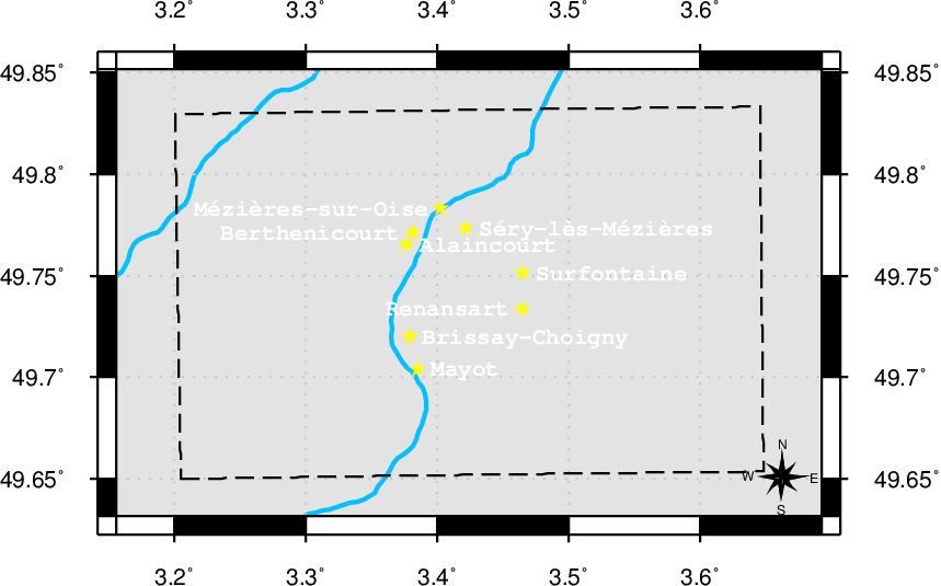
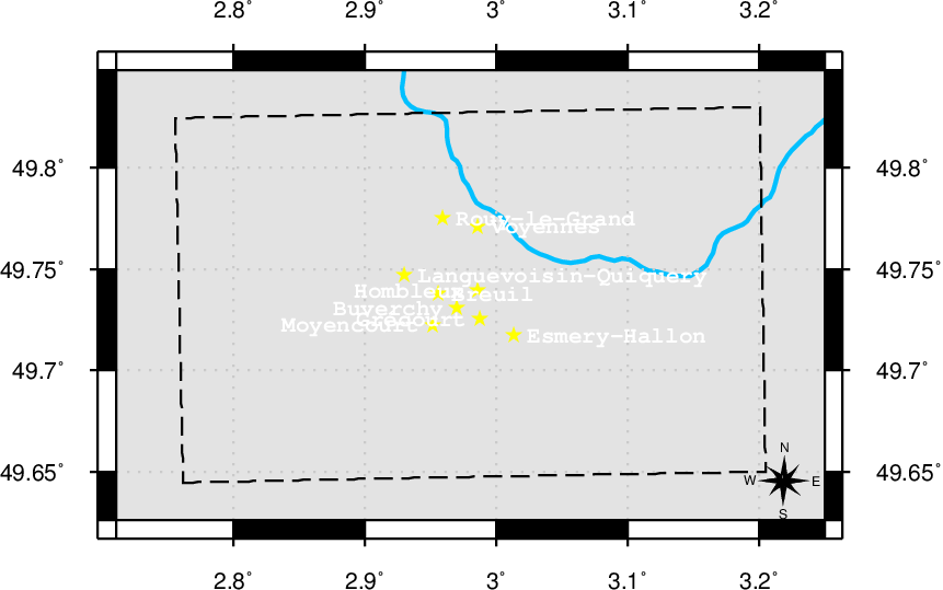
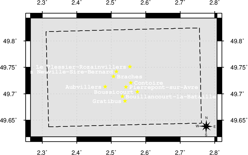
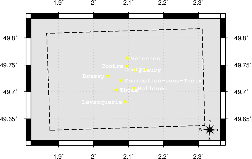
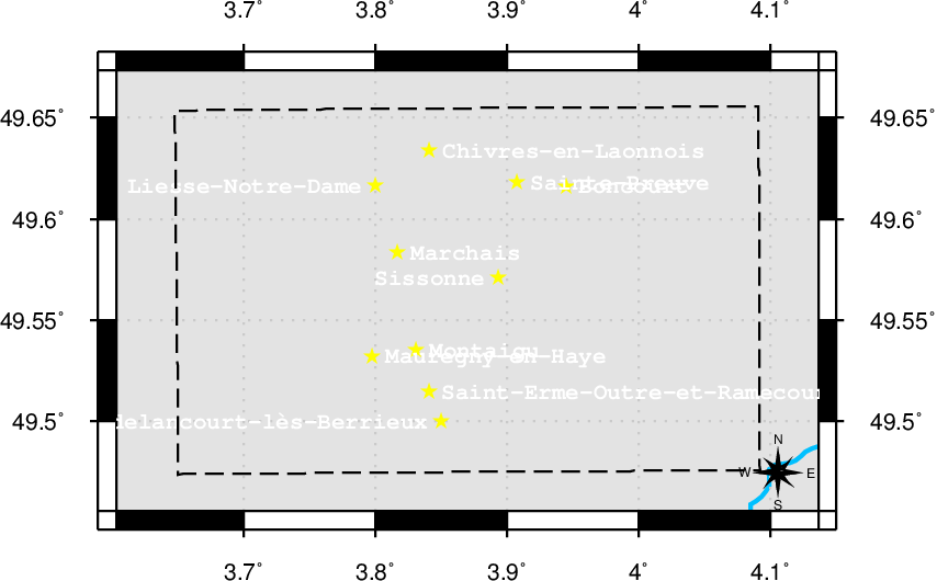
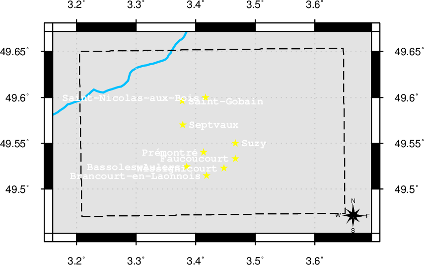
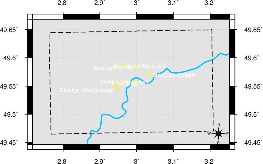
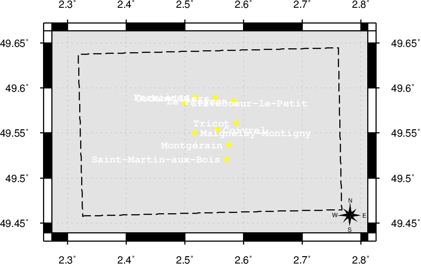
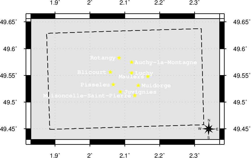
Acheux-en-Amiénois [#40000-57d], Acheux-en-Vimeu [#40000-57f], Airon-Notre-Dame [#40000-44d], Airon-Saint-Vaast [#40000-44d], Alaincourt [#40000-66c], Ambleteuse [#40000-27b], Aubigny [#40000-62d], Aubvillers [#40000-66e], Auchy-la-Montagne [#40000-70g], Auchy-lès-Hesdin [#40000-44c], Audinghen [#40000-19b], Audresselles [#40000-27b], Authie [#40000-57d], Autreppes [#40000-62a], Avesnes-le-Comte [#40000-51c], Avesnes-le-Sec [#40000-51a], Avondance [#40000-44c], Bajus [#40000-36b], Béalencourt [#40000-44c], Barastre [#40000-57c], Barly [#40000-51c], Bassoles-Aulers [#40000-70d], Bavinchove [#40000-27], Beaufort-Blavincourt [#40000-51c], Beaumetz-lès-Cambrai [#40000-57c], Beaumont-en-Cambrésis [#40000-57b], Belleuse [#40000-66f], Berck [#40000-44d], Berck-Plage [#40000-44d], Bergues [#40000-19], Berthenicourt [#40000-66c], Bertincourt [#40000-57c], Bertrancourt [#40000-57d], Bertry [#40000-57b], Beugin [#40000-36b], Beugny [#40000-57c], Biache-Saint-Vaast [#40000-51b], Blicourt [#40000-70g], Boiry-Notre-Dame [#40000-51b], Boncourt [#40000-70c], Bonnay [#40000-62d], Bonningues-lès-Ardres [#40000-27a], Bosmont-sur-Serre [#40000-66a], Bougainville [#40000-62e], Bouillancourt-la-Bataille [#40000-66e], Boulogne-sur-Helpe [#40000-57a], Boussicourt [#40000-66e], Braches [#40000-66e], Brancourt-en-Laonnois [#40000-70d], Brassy [#40000-66f], Bray-Dunes [#40000-11], Bredene [#40000-4], Breuil [#40000-66d], Briquemesnil-Floxicourt [#40000-62e], Brissay-Choigny [#40000-66c], Brucamps [#40000-57e], Buire-Courcelles [#40000-62c], Buironfosse [#40000-62a], Burelles [#40000-66a], Bus [#40000-57c], Busnes [#40000-36a], Bussu [#40000-62c], Buverchy [#40000-66d], Calonne-Ricouart [#40000-36b], Camiers [#40000-36e], Capinghem [#40000-36], Cartignies [#40000-57a], Cartigny [#40000-62c], Carvin [#40000-36c], Cassel [#40000-27], Caudry [#40000-57b], Caullery [#40000-57b], Caumont [#40000-51d], Cavillon [#40000-62e], Cayenne [#40000-70h], Chiry-Ourscamp [#40000-70e], Chivres-en-Laonnois [#40000-70c], Chépy [#40000-57f], Cilly [#40000-66a], Clary [#40000-57b], Clerques [#40000-27a], Coigneux [#40000-57d], Coivrel [#40000-70f], Condette [#40000-36e], Contoire [#40000-66e], Contre [#40000-66f], Conty [#40000-66f], Corbie [#40000-62d], Courcelles-sous-Thoix [#40000-66f], Courrières [#40000-36c], Croix-Fonsomme [#40000-62b], Crèvecœur-le-Petit [#40000-70f], Dannes [#40000-36e], De Haan [#40000-4], De Panne [#40000-11], Divion [#40000-36b], Doingt [#40000-62c], Domart-en-Ponthieu [#40000-57e], Domqueur [#40000-57e], Douchy-les-Mines [#40000-51a], Dourges [#40000-36c], Englancourt [#40000-62a], Englos [#40000-36], Ennetières-en-Weppes [#40000-36], Ergnies [#40000-57e], Erloy [#40000-62a], Erquinghem-le-Sec [#40000-36], Escalles [#40000-19b], Escobecques [#40000-36], Esmery-Hallon [#40000-66d], Essigny-le-Petit [#40000-62b], Estevelles [#40000-36c], Estrées-Mons [#40000-62c], Faucoucourt [#40000-70d], Favières [#40000-51e], Ferrières [#40000-70f], Feuquières-en-Vimeu [#40000-57f], Fieulaine [#40000-62b], Fleury [#40000-66f], Fluy [#40000-62e], Fonsomme [#40000-62b], Fontaine-Notre-Dame [#40000-62b], Fontaine-Uterte [#40000-62b], Forceville [#40000-57d], Fosseux [#40000-51c], Fouquières-lès-Lens [#40000-36c], Fourdrinoy [#40000-62e], Franleu [#40000-57f], Franqueville [#40000-57e], Fransu [#40000-57e], Fresnoy-le-Grand [#40000-62b], Fressin [#40000-44c], Froidestrées [#40000-62a], Gennes-Ivergny [#40000-51d], Gergny [#40000-62a], Ghyvelde [#40000-11], Gistel [#40000-12], Givenchy-le-Noble [#40000-51c], Godenvillers [#40000-70f], Gorenflos [#40000-57e], Goudelancourt-lès-Berrieux [#40000-70c], Grand-Fayt [#40000-57a], Grand-Rullecourt [#40000-51c], Gratibus [#40000-66e], Grécourt [#40000-66d], Gronard [#40000-66a], Guarbecque [#40000-36a], Hallennes-lez-Haubourdin [#40000-36], Hamblain-les-Prés [#40000-51b], Hamelet [#40000-62d], Haplincourt [#40000-57c], Hardifort [#40000-27], Hargnies [#40000-51], Harnes [#40000-36c], Hasnon [#40000-44], Haspres [#40000-51a], Haucourt [#40000-51b], Haulchin [#40000-51a], Haverskerque [#40000-36a], Heilly [#40000-62d], Hénin-Beaumont [#40000-36c], Hombleux [#40000-66d], Houdain [#40000-36b], Houry [#40000-66a], Houthulst [#40000-20], Hoymille [#40000-19], Isbergues [#40000-36a], Juvignies [#40000-70g], La Comté [#40000-36b], La Loge [#40000-44c], La Longueville [#40000-51], Léalvillers [#40000-57d], La Neuville-Bosmont [#40000-66a], La Neuville-Sire-Bernard [#40000-66e], Languevoisin-Quiquery [#40000-66d], Lavacquerie [#40000-66f], Lebucquière [#40000-57c], Lecelles [#40000-44], Le Crotoy [#40000-51e], Leffrinckoucke [#40000-11], Le Plessier-Rozainvillers [#40000-66e], Le Ployron [#40000-70f], Le Ponchel [#40000-51d], Lerzy [#40000-62a], Liesse-Notre-Dame [#40000-70c], Ligny-en-Cambrésis [#40000-57b], Lomme [#40000-36], Louches [#40000-27a], Louvencourt [#40000-57d], Luchy [#40000-70g], Maignelay-Montigny [#40000-70f], Maisoncelle-Saint-Pierre [#40000-70g], Manin [#40000-51c], Marbaix [#40000-57a], Marchais [#40000-70c], Maulers [#40000-70g], Mauregny-en-Haye [#40000-70c], Mayot [#40000-66c], Mentque-Nortbécourt [#40000-27a], Merlimont [#40000-44d], Mesnil-Bruntel [#40000-62c], Millonfosse [#40000-44], Monchaux-sur-Écaillon [#40000-51a], Montaigu [#40000-70c], Montgérain [#40000-70f], Montigny-en-Arrouaise [#40000-62b], Montigny-en-Cambrésis [#40000-57b], Montigny-en-Gohelle [#40000-36c], Morlincourt [#40000-70e], Mouflers [#40000-57e], Moyencourt [#40000-66d], Muidorge [#40000-70g], Mézières-sur-Oise [#40000-66c], Nesles [#40000-36e], Neslette [#40000-62f], Neufchâtel-Hardelot [#40000-36e], Nordausques [#40000-27a], Nort-Leulinghem [#40000-27a], Noyelles-sur-Selle [#40000-51a], Noyelle-Vion [#40000-51c], Noyon [#40000-70e], Ochancourt [#40000-57f], Oignies [#40000-36c], Oissy [#40000-62e], Ostend [#40000-4], Oudezeele [#40000-27], Ourton [#40000-36b], Oye-Plage [#40000-19a], Passel [#40000-70e], Pelves [#40000-51b], Petit-Fayt [#40000-57a], Pierrepont-sur-Avre [#40000-66e], Épinoy [#40000-36c], Pisseleu [#40000-70g], Planques [#40000-44c], Prisces [#40000-66a], Prémesques [#40000-36], Prémontré [#40000-70d], Péronne [#40000-62c], Prouvy [#40000-51a], Quaregnon [#40000-45], Équihen-Plage [#40000-36e], Ranchicourt [#40000-36b], Rang-du-Fliers [#40000-44d], Renansart [#40000-66c], Riencourt [#40000-62e], Rémy [#40000-51b], Rogny [#40000-66a], Rotangy [#40000-70g], Rouvignies [#40000-51a], Rouy-le-Grand [#40000-66d], Rue [#40000-51e], Ruyaulcourt [#40000-57c], Sailly-en-Ostrevent [#40000-51b], Sailly-le-Sec [#40000-62d], Sains-lès-Fressin [#40000-44c], Saint-Algis [#40000-62a], Saint-Amand-les-Eaux [#40000-44], Sainte-Marie-Cappel [#40000-27], Sainte-Preuve [#40000-70c], Saint-Erme-Outre-et-Ramecourt [#40000-70c], Saint-Gobain [#40000-70d], Saint-Hilaire-sur-Helpe [#40000-57a], Saint-Léger-lès-Authie [#40000-57d], Saint-Martin-aux-Bois [#40000-70f], Saint-Nicolas-aux-Bois [#40000-70d], Saint-Pierremont [#40000-66a], Saint-Quentin-en-Tourmont [#40000-51e], Saint-Venant [#40000-36a], Saisseval [#40000-62e], Saulzoir [#40000-51a], Seboncourt [#40000-62b], Sempigny [#40000-70e], Septvaux [#40000-70d], Sequedin [#40000-36], Seux [#40000-62e], Sint-Maria-Lierde [#40000-30], Sissonne [#40000-70c], Sombrin [#40000-51c], Sorbais [#40000-62a], Séry-lès-Mézières [#40000-66c], Steenbecque [#40000-36a], Surcamps [#40000-57e], Surfontaine [#40000-66c], Suzoy [#40000-70e], Suzy [#40000-70d], Étaing [#40000-51b], Taisnières-en-Thiérache [#40000-57a], Tardinghen [#40000-19b], Tavaux-et-Pontséricourt [#40000-66a], Étaves-et-Bocquiaux [#40000-62b], Terdeghem [#40000-27], Éterpigny [#40000-51b], Thiant [#40000-51a], Thiembronne [#40000-36d], Thiennes [#40000-36a], Thoix [#40000-66f], Thun-Saint-Amand [#40000-44], Torcy [#40000-44c], Tournehem-sur-la-Hem [#40000-27a], Étréaupont [#40000-62a], Tricot [#40000-70f], Troisvilles [#40000-57b], Téteghem [#40000-19], Uxem [#40000-19], Vaire-sous-Corbie [#40000-62d], Valines [#40000-57f], Vauchelles [#40000-70e], Vauchelles-lès-Authie [#40000-57d], Vauchelles-lès-Domart [#40000-57e], Vaulx [#40000-51d], Vaux-sur-Somme [#40000-62d], Velennes [#40000-66f], Verton [#40000-44d], Vieux-Mesnil [#40000-51], Ville [#40000-70e], Vis-en-Artois [#40000-51b], Vitz-sur-Authie [#40000-51d], Vélu [#40000-57c], Voyennes [#40000-66d], Wachtebeke [#40000-14], Wambercourt [#40000-44c], Warhem [#40000-19], Wemaers-Cappel [#40000-27], Willencourt [#40000-51d], Wimereux [#40000-27b], Wimille [#40000-27b], Wismes [#40000-36d], Wissant [#40000-19b], Wissignicourt [#40000-70d], Zermezeele [#40000-27], Zouafques [#40000-27a], Zuydcoote [#40000-11], Zuytpeene [#40000-27]
Battle of Albert (1916) [#40000-62d], Battle of Amiens [#40000-62e], Battle of the Ancre [#40000-57d], Battle of Arras [#40000-51b], Battle of Arras [#40000-51b], Battle of Aubers Ridge [#40000-36], Battle of Bazentin Ridge [#40000-57c], Battle of Broodseinde [#40000-28], Battle of Cambrai (1918) [#40000-57b], Battle of Cambrai [#40000-57b], Battle of Delville Wood [#40000-57c], Battle of Festubert [#40000-36], Battle of Festubert [#40000-36], Battle of Fromelles [#40000-36], Battle of Ginchy [#40000-57c], Battle of Guillemont [#40000-57c], Battle of Guise [#40000-62b], Battle of Guise [#40000-62b], Battle of Hamel [#40000-51b], Battle of Havrincourt [#40000-57c], Battle of Hill 70 [#40000-36c], Battle of the Hohenzollern Redoubt [#40000-36c], Battle of Hulluch [#40000-36c], Battle of Le Cateau [#40000-57b], Battle of Le Transloy [#40000-57c], Battle of Loos [#40000-36c], Battle of Mons [#40000-45], Battle of Mont Saint-Quentin [#40000-62c], Battle of Morval [#40000-57c], Battle of Passchendaele [#40000-28], First Battle of Passchendaele [#40000-28], Second Battle of Passchendaele [#40000-28], Battle of Poelcappelle [#40000-20], Battle of Polygon Wood [#40000-28], Battle of the Scarpe (1918) [#40000-51b], Battle of Thiepval Ridge [#40000-57d], Second Battle of Villers-Bretonneux [#40000-62d], Battle of Vimy Ridge [#40000-36c], Third Battle of Ypres [#40000-28], First Battle of Ypres [#40000-28], Second Battle of Ypres [#40000-28], Hundred Days Offensive, 1918 [#40000-62e], Noreuil [#40000-57c], Siege of Maubeuge [#40000-51]
| [1] | World War I military maps and aerial photography, April 2013. [ http ] |
| [2] | Matthew Perry. OGC GeoSPARQL - A Geographic Query Language for RDF Data. Open Geospatial Consortium, 09 2012. |
| [3] | April 2013. [ http ] |
| [4] |
Claus Stadler, Jens Lehmann, Konrad Höffner, and Sören Auer.
Linkedgeodata: A core for a web of spatial open data.
Semantic Web Journal, 3(4):333-354, 2012.
[ .pdf ]
Keywords: 2011 MOLE auer hoeffner lehmann lgd stadler sys:relevantFor:bis sys:relevantFor:infai |
| [5] | Clifford J. Mugnier. The kingdom of belgium. PHOTOGRAMMETRIC ENGINEERING & REMOTE SENSING, pages 956-957, October 1998. |
| [6] | March 2013. [ http ] |
| [7] | Howard Anderson. How to find a point on a Great War trench map. The Western Front Association, October 2008. |
| [8] | Institut cartographique militaire. Triangulation du Royaume de Belgique. Number v. 2-3 in Triangulation du Royaume de Belgique. Cnophs, 1867. [ http ] |
| [9] | W.C. Thue. The ABC universal commercial electric telegraphic code. 1880. [ http ] |
| [10] | February 2013. [ http ] |
| [11] | E. M. Jack. Report on survey on the Western Front 1914-1918. Volume 2 of [13], 1920. |
| [12] | E. M. Jack. Report on survey on the Western Front 1914-1918. Volume 1 of [13], 1920. |
| [13] | E. M. Jack. Report on survey on the Western Front 1914-1918. His Majesty's Stationery Office, London, 1920. |
| [14] | A R Hinks. Map Projections, by Arthur R. Hinks,... the University Press, 1912. [ http ] |
| [15] | Arthur R. Hinks. German war maps and survey. The Geographical Journal, 53(1):pp. 30-40, 1919. [ http ] |
| [16] | Charles Close, Lieut.-Colonel Jack Keeling, Lieut.-Colonel Salmon, Colonel McCaw, Captain, Captain Jones, C. B. Simonds, and H. S. L. Winterbotham. British survey on the western front: Discussion. The Geographical Journal, 53(4):pp. 271-276, 1919. [ http ] |
| [17] | H. S. L. Winterbotham. British survey on the western front. The Geographical Journal, 53(4):pp. 253-271, 1919. [ http ] |